Satellite Signals Surveying Set
Item Name Code (INC) 80332
 |
This is a collection of items, such as a Global Positioning System (GPS) receiver, a Real Time Kinematic (RTK) radio, a survey controller, an ANTENNA, aPOWER SUPPLY and the like. This set employs satellite signals from a GPS satellite constellation to gather precise positioning information of a terrestrial location, to include longitude, latitude and elevation.
 Additional Information for Satellite Signals Surveying Set
A Satellite Signals Surveying Set is a collection of instruments used in the field of surveying and mapping to receive and analyze satellite signals for precise positioning and data collection. This set typically includes the following components:
1. GNSS Receiver: This is the main device used to receive signals from multiple satellite constellations (such as GPS, GLONASS, Galileo, and BeiDou) to determine accurate positions on the Earth's surface.
2. Antenna: The antenna is used to receive satellite signals and transmit them to the GNSS receiver. It is designed to have a clear line of sight to the satellites for optimal signal reception.
3. Data Collector: This is a handheld device used to collect and store data from the GNSS receiver. It may have a touchscreen interface and various data input options, such as a keyboard or stylus.
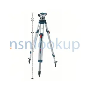
4. Tripod: A tripod is used to securely mount the GNSS receiver and antenna at a fixed location during surveying operations. It provides stability and ensures accurate measurements.
5. Accessories: The set may also include additional accessories such as cables, chargers, carrying cases, and software for data processing and analysis.
The Satellite Signals Surveying Set is essential for conducting precise surveys, mapping, and geospatial data collection. It allows surveyors and mapping professionals to accurately determine positions, elevations, and distances, which are crucial for various applications like construction, land development, and environmental monitoring.
Related Item Names for INC 80332 Satellite Signals Surveying Set
NATO Stock Numbers with Item Name 80332 Satellite Signals Surveying Set Page 1 of 1
- 017075495
- 100112-CTI
- RNCC: 3 | RNVC: 2
- 017074048
- 100107-CTI
- RNCC: 3 | RNVC: 2
- 016333636
- 1009775
- RNCC: 3 | RNVC: 2
- AN/GSN-16
- RNCC: 5 | RNVC: 2
- 016569463
- 90911-60
- RNCC: 3 | RNVC: 2
- 90911-60
- RNCC: 5 | RNVC: 2
- 016756704
- OR0991
- RNCC: 3 | RNVC: 2
- 016569412
- 90909-60
- RNCC: 3 | RNVC: 2
- 90909-60
- RNCC: 5 | RNVC: 2