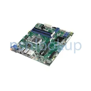
Geospatial Intelligence Workstation
Item Name Code (INC) 68864
- Information Technology Equipment System Configuration
- Federal Supply Class: FSC 7010
- NATO Supply Classification Class: NSC 7010
- Information Technology Equipment (Including Firmware), Software, Supplies and Support Equipment
- Federal Supply Group: FSG 70
- NATO Supply Classification Group: NSG 70
- Item Hits: 20
 |
A tactical, computer-based system that allows the Geospatial Intelligence Analyst to utilize hardcopy and digital terrain data to produce real time and near real time information for the battlefield commander. It also allows for the hardcopy production of large format, multicolor topographic products in a timely manner. It comes in a Light version and a Deployable version. The Light version has the equipment installed in a shelter mounted on the back of a vehicle with a towed generator and the Deployable version is fitted in transit cases. This item is a member of the DISTRIBUTED COMMON GROUND SYSTEM - Army family of systems.
 Additional Information for Geospatial Intelligence Workstation
Geospatial Intelligence Workstations are specialized computer systems designed for processing and analyzing geospatial data. They are part of the supply class Information Technology Equipment System Configuration, which refers to the specific configuration and setup of the IT equipment.
In the supply group Information Technology Equipment (Including Firmware), Software, Supplies And Support Equipment, Geospatial Intelligence Workstations fall under the category of hardware or physical equipment. These workstations are typically equipped with high-performance processors, large amounts of RAM, and powerful graphics cards to handle the complex calculations and visualizations required for geospatial analysis.
Geospatial Intelligence Workstations are specifically designed to support the needs of professionals working in the field of geospatial intelligence. This includes tasks such as satellite imagery analysis, mapping, geospatial data integration, and geospatial modeling. These workstations often come pre-installed with specialized software and tools for geospatial analysis, such as Geographic Information Systems (GIS) software.
In summary, Geospatial Intelligence Workstations are advanced computer systems that are optimized for processing and analyzing geospatial data. They are part of the supply class Information Technology Equipment System Configuration and fall under the supply group Information Technology Equipment (Including Firmware), Software, Supplies And Support Equipment.
 Related Item Names for INC 68864 Geospatial Intelligence Workstation
 NATO Stock Numbers with Item Name 68864 Geospatial Intelligence Workstation Page 1 of 1
- 016839068
- CW-SCD2834TA
- RNCC: 3 | RNVC: 2
- CW-SCD2834TAJ
- RNCC: 5 | RNVC: 9
- 190211B1100-0
- RNCC: D | RNVC: 9
- 016051985
- MAXPAC8241XRA2
- RNCC: 3 | RNVC: 2
- 016835611
- CW-SCDP2834A
- RNCC: 3 | RNVC: 2
- RPW-SCD2834A
- RNCC: 5 | RNVC: 9
- RPW-SCDP2834A
- RNCC: 5 | RNVC: 9
- 016748080
- A3359855
- RNCC: 3 | RNVC: 2
- AN/TYQ-71C(V)4
- RNCC: 5 | RNVC: 2
- 016181221
- 225-0805
- RNCC: 3 | RNVC: 2
- AN/TYQ-71A(V)3
- RNCC: 5 | RNVC: 1
- 016963562
- 19011G0000-0
- RNCC: 3 | RNVC: 2
- 014830562
- A3281303-1
- RNCC: 3 | RNVC: 2
- A3281303-1
- RNCC: 3 | RNVC: 2
- AN/TYQ-71(V)1
- RNCC: 5 | RNVC: 2
- 016926445
- ISA8276SYS
- RNCC: 3 | RNVC: 2
- AN/TYQ-71D(V)4
- RNCC: 5 | RNVC: 2
- 014255602
- TEC00100
- RNCC: 3 | RNVC: 2
- AN/TYQ-71
- RNCC: 5 | RNVC: 2
- 016849078
- CHS00201233-1
- RNCC: 3 | RNVC: 2
- AN/TYQ-170(V)1
- RNCC: 5 | RNVC: 2
- MAXPAC8276XL2
- RNCC: 5 | RNVC: 9
- 015145000
- A3281303
- RNCC: 3 | RNVC: 2
- A3281303-3
- RNCC: 3 | RNVC: 2
- AN/TYQ-71A(V)1
- RNCC: 5 | RNVC: 2
- 016254072
- 775-90278-1
- RNCC: 3 | RNVC: 2
- 015428162
- A3281303-4
- RNCC: 3 | RNVC: 2
- AN/TYQ-71(V)3
- RNCC: 3 | RNVC: 2
- A3281303-4
- RNCC: 5 | RNVC: 2
- 016571240
- A3359854
- RNCC: 3 | RNVC: 2
- 016529937
- A3357169
- RNCC: 3 | RNVC: 2
- 016254071
- 775-90278-2
- RNCC: 3 | RNVC: 2
- 014830563
- A3281303-2
- RNCC: 3 | RNVC: 2
- A3281303-2
- RNCC: 3 | RNVC: 2
- AN/TYQ-71(V)2
- RNCC: 5 | RNVC: 2
- 661608711
- SCES20250
- RNCC: 3 | RNVC: 2
- 998379534
- K543480
- RNCC: 3 | RNVC: 2
- 55942700
- RNCC: 6 | RNVC: 9
- XZ55942700
- RNCC: 6 | RNVC: 9
- 992802781
- K543528
- RNCC: 3 | RNVC: 2
- 55952700
- RNCC: 6 | RNVC: 9
- XZ55952700
- RNCC: 6 | RNVC: 9