Cartographic Instrument Shop Equipment
Item Name Code (INC) 34538
 |
 Additional Information for Cartographic Instrument Shop Equipment
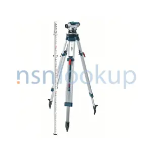
Cartographic Instrument Shop Equipment refers to the tools and equipment used in a shop or store that specializes in selling instruments related to drafting, surveying, and mapping. These instruments are used by professionals in the field of cartography to create accurate and detailed maps.
Some examples of Cartographic Instrument Shop Equipment include:
1. Drafting tables: These are large, adjustable tables used for drawing and drafting maps. They usually have a smooth surface and a built-in ruler or measuring scale.
2. Compasses: Compasses are used to draw circles and arcs on maps. They consist of two arms, one with a pointed end and the other with a pencil or pen holder.
3. Protractors: Protractors are used to measure and draw angles on maps. They are typically semi-circular in shape and have markings for degrees.
4. T-squares: T-squares are used to draw straight lines on maps. They consist of a long, straight edge with a perpendicular crossbar at one end.
5. Map scales: Map scales are used to measure distances on maps. They are usually in the form of a ruler or a set of rulers with different scales.
6. Surveying instruments: These include tools such as theodolites, total stations, and GPS devices used for precise measurement and mapping of land features.
7. Mapping software: In addition to physical instruments, cartographic instrument shops may also offer mapping software that allows professionals to create and edit digital maps.
These are just a few examples of the Cartographic Instrument Shop Equipment available in the Drafting, Surveying, and Mapping Instruments supply class. The specific equipment offered may vary depending on the shop and its specialization.
Related Item Names for INC 34538 Cartographic Instrument Shop Equipment
NATO Stock Numbers with Item Name 34538 Cartographic Instrument Shop Equipment Page 1 of 1
- 010919631
- 1249-2
- RNCC: 3 | RNVC: 2
- 1249-2
- RNCC: 5 | RNVC: 9
- 006413623
- SC6675-97-CL-E12
- RNCC: 3 | RNVC: 9