Premium Information is available for this item - Upgrade for $1 a day
7643-01-448-3716
Topographic Geospatial Products
7643014483716 014483716 M737X56 M737 56
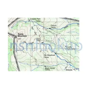
A map, chart, or geodetic product, distributed by Agencies such as the Defense Mapping Agency, which is associated with land navigation, tracking, and charting. View more Topographic Geospatial Products
![]()
Managed by United States
NSN Created on 27 Aug 1997
Data Last Changed
November 2023
November 2023
NATO Update Count
4
4
NATO Data Quality

 Marketplace 7643-01-448-3716
Need Help?
Request a Quotation from participating marketplace vendors
Request a Quotation from participating marketplace vendors
 Related Documents 7643-01-448-3716 5+ Documents (More...)
JavaScript in your web browser . 7643-13-120-4067Topographic Geospatial Products7643131204067 131204067 M737X56
M737 56 A map, chart, or geodetic product, distributed by Agencies such as the Defense Mapping Agency
NumberManufacturerStatusM737 56 B0760 - Institut Geographique National (Active) Primary Buy RNCC 3 RNVC 2 DAC 6 M737X56
M737 56 A map, chart, or geodetic product, distributed by Agencies such as the Defense Mapping Agency
NumberManufacturerStatusM737 56 B0760 - Institut Geographique National (Active) Primary Buy RNCC 3 RNVC 2 DAC 6 M737X56
7643-01-440-8503 7643014408503 014408503 is a map, chart, or geodetic product, distributed by agencies such as the defense mapping agency, which is associated with land navigation, tracking, and charting.
7643-13-120-4068 7643131204068 131204068 is a map, chart, or geodetic product, distributed by agencies such as the defense mapping agency, which is associated with land navigation, tracking, and charting.
7640-13-119-1702 7640131191702 131191702 is a sheet or plate representing on a plain surface all or part of earth's surface, showing physical, natural, statistical and/or political features, or division. excludes chart; chart, recording instrument; plate, instruction; and sheet, technical.
7643-13-119-8664 7643131198664 131198664 is a map, chart, or geodetic product, distributed by agencies such as the defense mapping agency, which is associated with land navigation, tracking, and charting.
 Restrictions 7643-01-448-3716
 Approved Sources 7643-01-448-3716
- Part Number
- Manufacturer
- Status
- M737 56
- Manufacturer
- 0ZP31 - National Geospatial-Intelligence (Active)
- Primary Buy
- Primary Buy
- M737X56
- 0ZP31 - National Geospatial-Intelligence (Active)
- Incomplete Secondary Reference
- Incomplete Secondary Reference
 Management Data 7643-01-448-3716
- Effective Date
- Organization
- Unit of Issue
- Unit Price
- Qty Unit Pack
- Unit of Issue
- Nov 2008
- Department of the Air Force (DF)
- EA
- Subscribe
- 1
- EA
- MOE
- USC
- Code
- Statement
- Order of Use
- Jump To Code
- Qty Per Assy
- UOM
- Technical Document
- Quantative Expression
- Code
- Department of the Air Force (DF)
- F
- A
- Consolidated With 7643-13-120-4067
- A
- DLA AVN Mapping Customer Operations (DP)
- I
- A
- Consolidated With 7643-13-120-4067
- A
 Army
Army
- Materiel Category and Inventory Manager:
- J
- Ground Forces Support Materiel (DLA/GSA Items)
- Appropriation and Budget Activity:
- 3
- O&MA Secondary Items
- Management Inventory Segment:
- 2
- Non-Repairable Items(Exclusive of Insurance and Provisioning Items)
This code will be used to identify items, which are not reparable.
- Weapons System / End Item / Homogeneous Group:
- 00
- DLA/GSA Material
DLA/GSA-Managed Items that cannot be identified to a specific Army Weapons Systems/End Item
- Accounting Requirements:
- X
- Expendable item.An item of Army property coded with an ARC of X in the AMDF. Expendable items require no formal accountability after issue from a stock record account.Commercial and fabricated items similar to items coded X in the AMDF are considered expendable items.
 NATO Stock Numbers Related to 7643-01-448-3716
7643-16-004-7430 7643-16-004-6258 7643-33-208-2841 7643-14-574-7540 7643-40-000-8653 7643-51-000-6339 7643-33-210-0161 7643-14-577-9411 7643-16-004-6244 7643-14-543-0071 7643-16-004-7137 7643-99-601-9094 7643-99-152-9149 7643-13-121-4867 7643-99-551-8372 7643-99-151-5096 7643-99-490-8075 7643-16-004-6347