7640-25-139-3877
Map
7640251393877 251393877 M711-2035 I-02 M711-2035 I-03 BOERSELV M7112035102
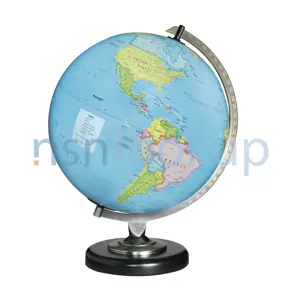
A sheet or plate representing on a plain surface all or part of earth's surface, showing physical, natural, statistical and/or political features, or division. Excludes CHART; CHART, RECORDING INSTRUMENT; PLATE, INSTRUCTION; and SHEET, TECHNICAL. View more Map
![]()
Managed by Norway
NSN Created on 5 Feb 1991
Data Last Changed
January 2023
January 2023
NATO Update Count
1
1
NATO Data Quality

 Marketplace 7640-25-139-3877
Need Help?
Request a Quotation from participating marketplace vendors
Request a Quotation from participating marketplace vendors
 Related Documents 7640-25-139-3877 2+ Documents (More...)
Documents 7640-25-151-6816 2+ Documents ( More... ) https//www.nsnlookup.com /fsg-76/fsc-7640/no 7640-25-139-3877
Map 7640251393877 251393877,M711-2035 I-02 https//www.nsnlookup.com /cage Forsvarets Militaergeografiske
Map 7640251393877 251393877,M711-2035 I-02 https//www.nsnlookup.com /cage Forsvarets Militaergeografiske
: 9 30 Aug 2005 7640-25-151-6816 Map M711OEV-1624-1-04RNCC: 3 | RNVC: 2 | DAC: 9 15 Oct 2004 7640-25-139-3877
 Restrictions 7640-25-139-3877
 End Users 7640-25-139-3877
- Norway (ZT)
 Approved Sources 7640-25-139-3877
- Part Number
- Manufacturer
- Status
- M711-2035 I-02
- Manufacturer
- N1572 - Forsvarets Militaergeografiske (Active)
- Primary Buy
- Primary Buy
- M711-2035 I-03
- N1572 - Forsvarets Militaergeografiske (Active)
- Primary Buy
- Primary Buy
- BOERSELV
- N1572 - Forsvarets Militaergeografiske (Active)
- NATO Reference
- NATO Reference
- M7112035102
- N1572 - Forsvarets Militaergeografiske (Active)
- NATO Reference
- NATO Reference
 NATO Stock Numbers Related to 7640-25-139-3877
7640-23-110-0540 7640-23-110-1818 7640-23-110-1916 7640-22-122-8477 7640-22-125-3268 7640-23-110-1459 7640-23-110-2526 7640-23-110-1472 7640-23-110-1484 7640-23-110-2091 7640-25-151-5641 7640-23-110-0408 7640-23-110-0942 7640-23-110-0297 7640-25-139-3876 7640-25-139-1173 7640-22-126-2191 7640-23-110-0490